

Sharing press release from Mary Ellen Lepionka and Bill Remsen followed by a selection of visual arts, maps, and writing spotlighting Dogtown (1633-1961) by Catherine Ryan.
Nov 29th, 7PM, Public Meeting
Come to a special public presentation November 29th in Kyrouz Auditorium in Gloucester City Hall, 9 Dale Avenue, at 7pm.
Week of Nov 13
“During the week of November 13 a team of archaeologists from the Public Archaeology Laboratory (PAL) in Providence will be conducting fieldwork in Dogtown. They will begin mapping and describing an area to be nominated to the National Register of Historic Places, a National Park Service program to honor historically significant buildings and landscapes.
What do you think?
“Presenters at City Hall on Nov 29th will include Betsy Friedberg from the Massachusetts Historical Commission, who will explain how the National Register program works and what it does and does not do, and Kristen Heitert from the PAL, who will present an initial plan for defining the boundaries of Dogtown as a National Register District. People attending the meeting will be asked to respond to that plan and to express their views about what makes Dogtown special. What should be the boundaries of the proposed National Register District, and what cultural features should be included in it? What would be the benefits of National Register status, and are there any drawbacks?
Who all is involved?
“The Dogtown archaeological survey is funded through a matching grant from the Massachusetts Historical Commission and the Dusky Foundation and is financed by the City of Gloucester. The Gloucester Historical Commission applied for the grant and is coordinating the project in collaboration with the Rockport Historical Commission. The PAL team will also have the assistance of members of the Dogtown Advisory Committee, the Rockport Rights of Way Committee, the Cape Ann Trail Stewards, and the Friends of Dogtown.”
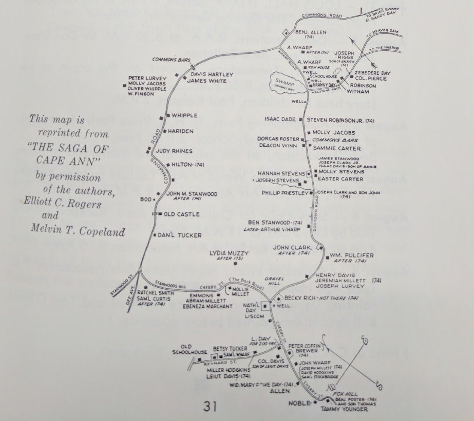
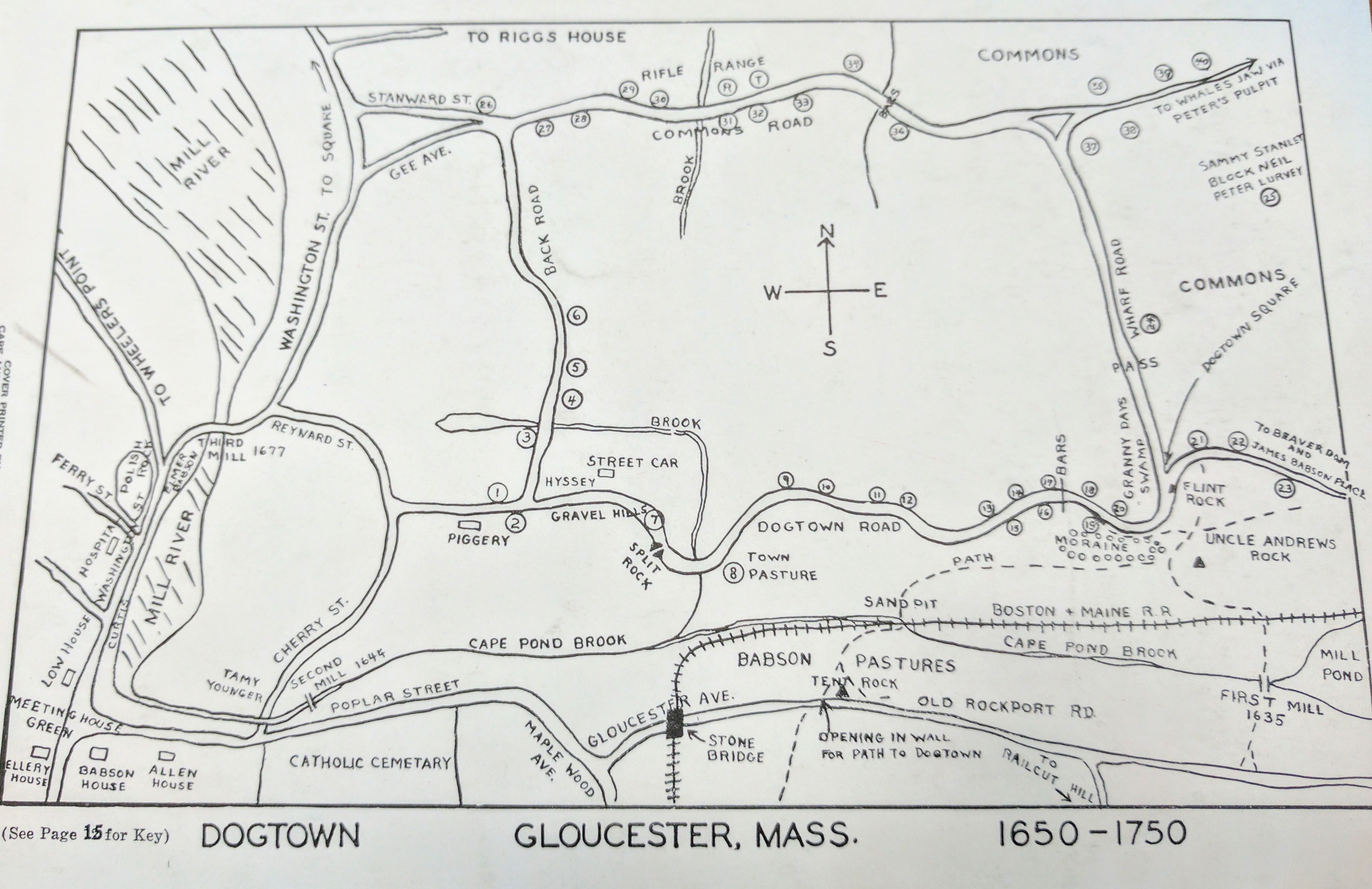
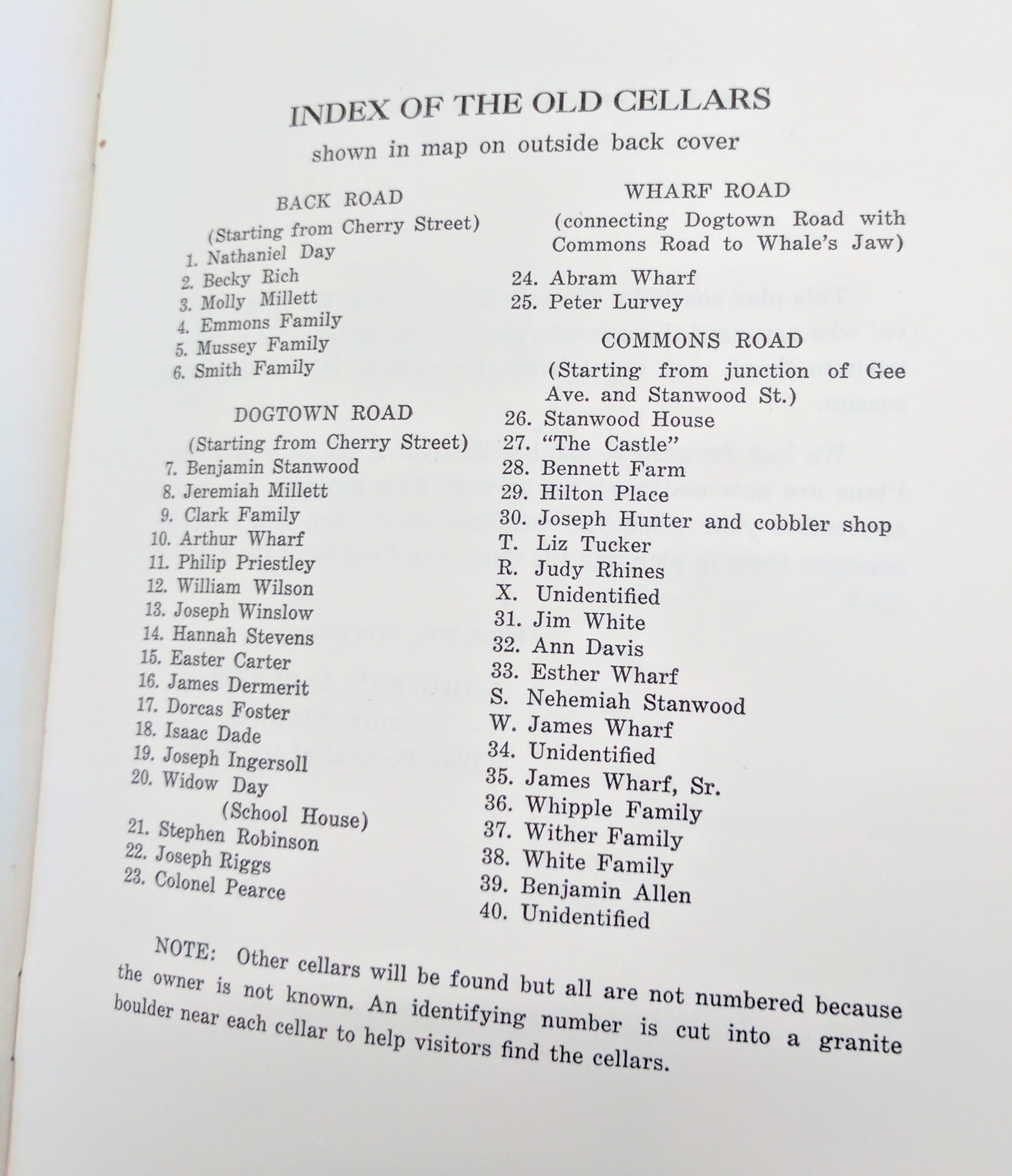
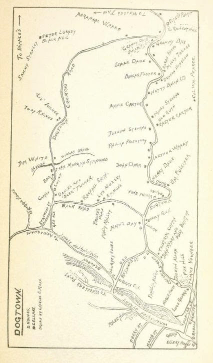
– Dogtown is eligible for the National Register. Will Gloucester earn another major district designation? Above excerpts from the press release for the Nov 29th event shared by Bill Remsen, local project coordinator, and Mary Ellen Lepionka, co-chair Gloucester Historical Commission, and some Dogtown maps and memorabilia 1633-1961
Dogtown Maps and memorabilia 1633-1961 selected by Catherine Ryan
Prior 2017 Dogtown public forums, lectures and meetings mentioned consideration of controlled burns to clear brush and return some land to a former moors state, with various potential benefits.
- “Nature takes a lot of courses.” Chris Leahy said. He focused on Dogtown, “a very special place”, and possible merits of land stewardship geared at fostering greater biodiversity. Perhaps some of the core acres could be coaxed to grasslands as when parts of Gloucester were described as moors? Characteristic wildlife, butterflies, and birds no longer present may swing back.” March 4 2017 Dogtown Forum at Cape Ann Museum in collaboration with Essex County Greenbelt, Mass Audubon, and Friends of Dogtown group
- February 23, 2017 Chris Leahy also gave a talk at Sawyer Free Library Dogtown- the Biography of a Landscape:750 Million Years Ago to the Present
A photographic history through slides presented by the Gloucester Lyceum and the Friends of the Library - March 6, 2017: NPR report “Forbidding Forecast for Lyme Disease in the Northeast” excerpt and article https://www.npr.org/player/embed/518219485/518743106
- “Today the Hudson River Valley in upstate New York is gorgeous. The hills are covered with oak forests, and the valleys are patchworks of hayfields and farms. But Ostfeld says the area didn’t always look like this. When the Europeans came here hundreds of years ago, they clear-cut nearly all of the forests to plant crops and raise livestock. “They also cut down trees for commercial use,” Ostfeld says, “to make masts for ships, and for firewood.” Since then a lot of the forest has come back — but it’s not the same forest as before, he says. Today it’s all broken up into little pieces, with roads, farms and housing developments. For mice, this has been great news. “They tend to thrive in these degraded, fragmented landscapes,” Ostfeld says, because their predators need big forests to survive. Without as many foxes, hawks and owls to eat them, mice crank out babies. And we end up with forests packed with mice — mice that are chronically infected with Lyme and covered with ticks.”
Selection of maps
from books, and memorabilia I’ve pulled on Dogtown (1634-1961):
1961
From Gloucester 1961 Cape Ann Festival of the Arts booklet
1954
From Gloucester 1954 Festival of the Arts booklet, prepared for the second of the Russel Crouse Prize Play, the Witch of Dogtown, by S. Foster Damon. “Each year it is hoped new plays dealing with the Gloucester or Cape Ann theme will be produced.”
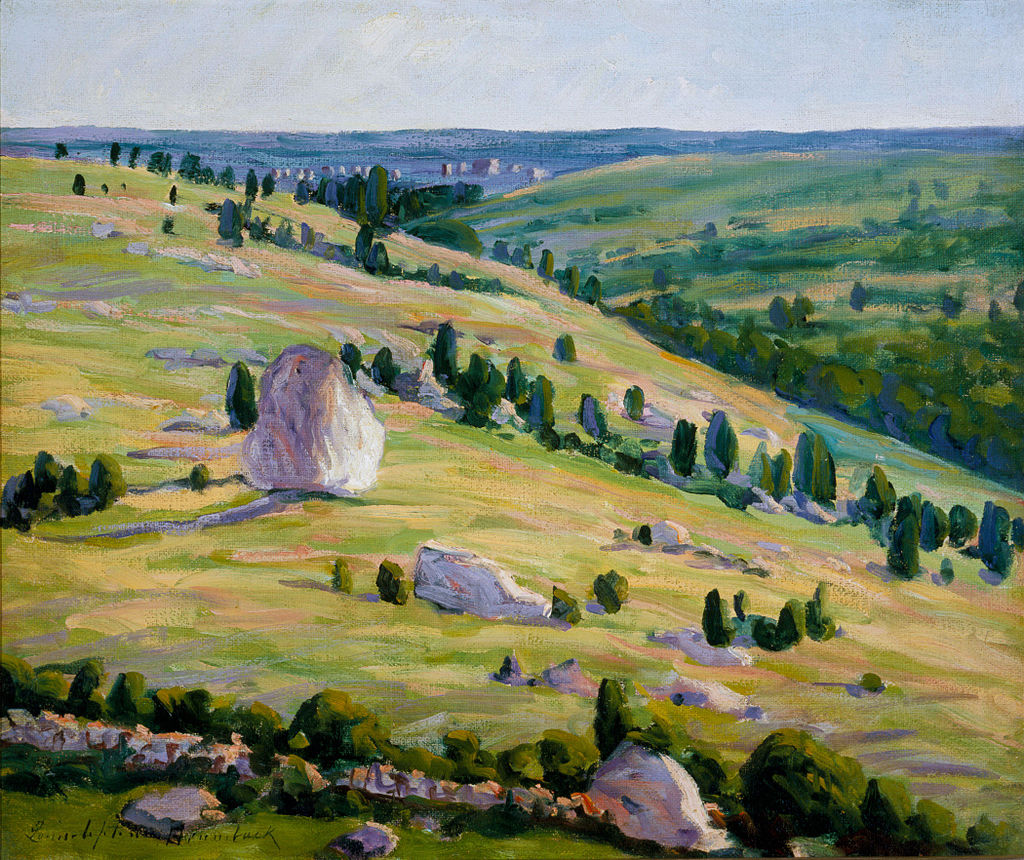
1923 Christian Science Monitor art review for Gloucester Society of Artists
“Dogtown Common, the now deserted hill home of the first settlers who 300 years ago braved the dangers of a hostile and Indian Annisquam, offers both romance and reality. It has remained for Louise Upton Brumback to interpret its clear contrasts, its far spaces, blue skies, white clouds and stiff green pointed cedars. Although the draftsmanship is crude in the extreme, the effect is rare and genuine. The old resident who passes through the gallery will shake his head dubiously at the false color creations of harbor and rock, but accepts this striking and bold visualization of Dogtown Common as the true spirit of Cape Ann…”
1921 Percy MacKaye Dogtown poem, 110+ pp
Inland among the lonely cedar dells
Of Old Cape Ann, near Gloucester by the Sea,
Still live the Dead–in homes that used to be.
All day in dreamy spells
They tattle low with sounds of tinkling cattle
bells
Or spirit tappings of some hollow tree
And there, all night–out of the
dark–
They bark–and bark…
“Note: From a little volume, by Charles E. Mann, entitled “In the Heart of Cape Ann” Gloucester, Mass., The Proctor Bros. Co), the curious reader may learn more strange, half forgotten facts concerning the old Puritan life of that region. Among its singular New England characters, certain authentic and legendary figures have entered the theme of this poem.
P.M-K. Miami University, Oxford, Ohio. March, 1921
Percy MacKaye (1875–1956) was an American dramatist and poet.
Harvard MacKaye papers: “History note: Percy Wallace MacKaye, author and dramatist, graduated from Harvard in 1897, wrote poetic dramas, operatic libretti, modern masques and spectacles, and was active in promoting community theatre. The collection includes his papers and those of his wife, Marion Homer Morse MacKaye, as well as material relating to the career of his father Steele MacKaye (1842-1894), an American theatrical designer, actor, dramatist, and inventor. The bulk of the collection consists of material pertaining to community drama; correspondence with literary and theatrical figures including Edgar Lee Masters, Edwin Arlington Robinson, George Pierce Baker, Theodore Dreiser, Amy Lowell, Upton Sinclair, Edward Gordon Craig, Louis Untermeyer and Thornton Wilder.”
Dartmouth: The MacKaye Family Papers “contain materials documenting the life and career of four generations of the family. They include a large amount of personal and professional correspondence as well as original manuscripts and typescripts of plays, prose, masques, pageants, poetry, essays and articles. Of note are manuscript materials for Benton MacKaye’s works on geotechnics entitled “Geotechnics of North America,” and “From Geography to Geotechnics,” as well as Percy MacKaye’s biography and works on his father Steele MacKaye and the MacKaye family, entitled respectively, “Epoch,” and “Annals of an Era.”
(Gloucester, Dogtown Common, is not on the MacKaye Wikipedia page)
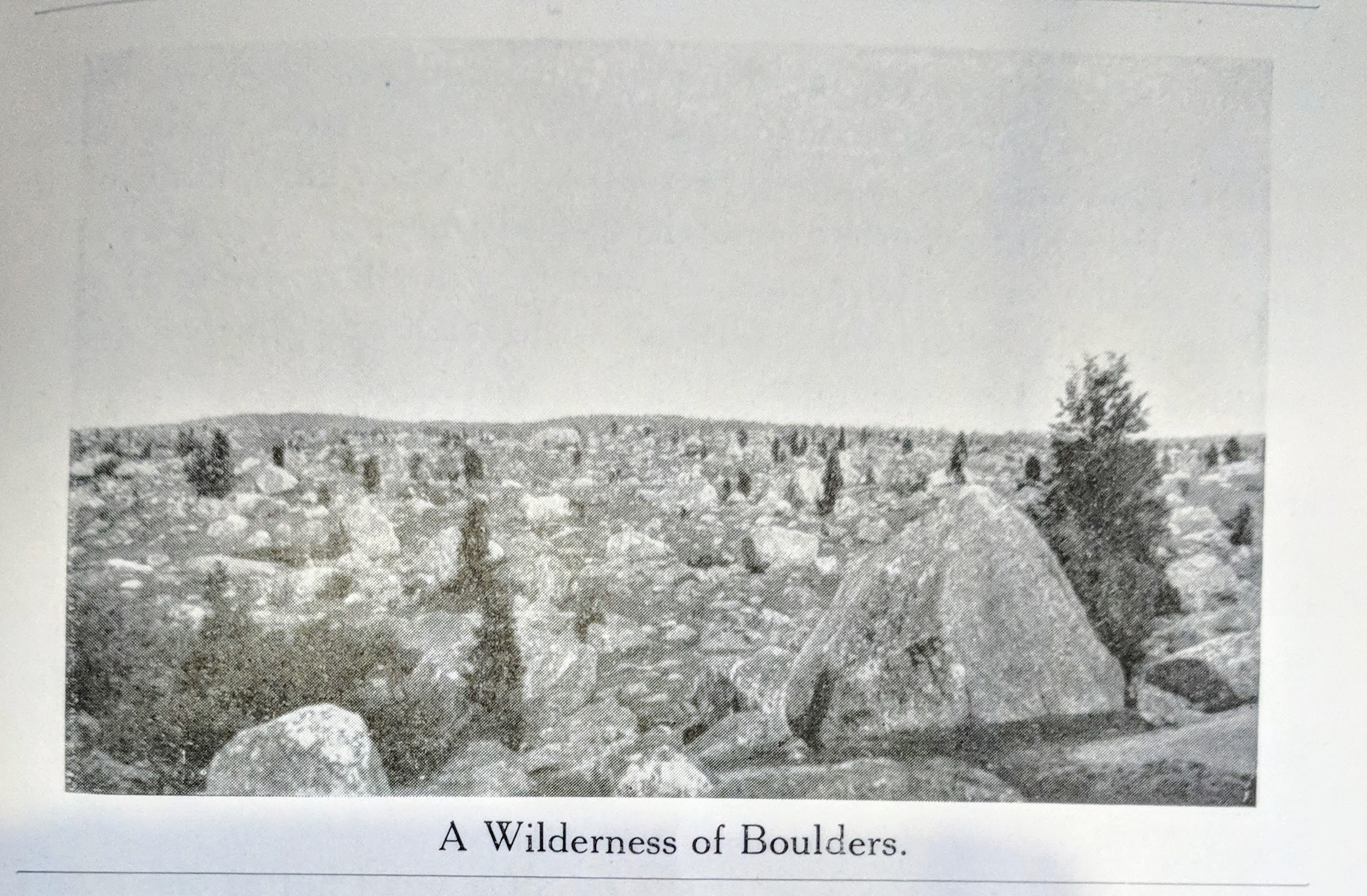
1921 Frank L Cox The Gloucester Book
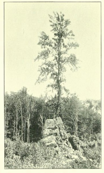
Business owner, photographer, author Frank L Cox devoted 7 pages and 4 photographs to illustrate the Dogtown and Its Story chapter
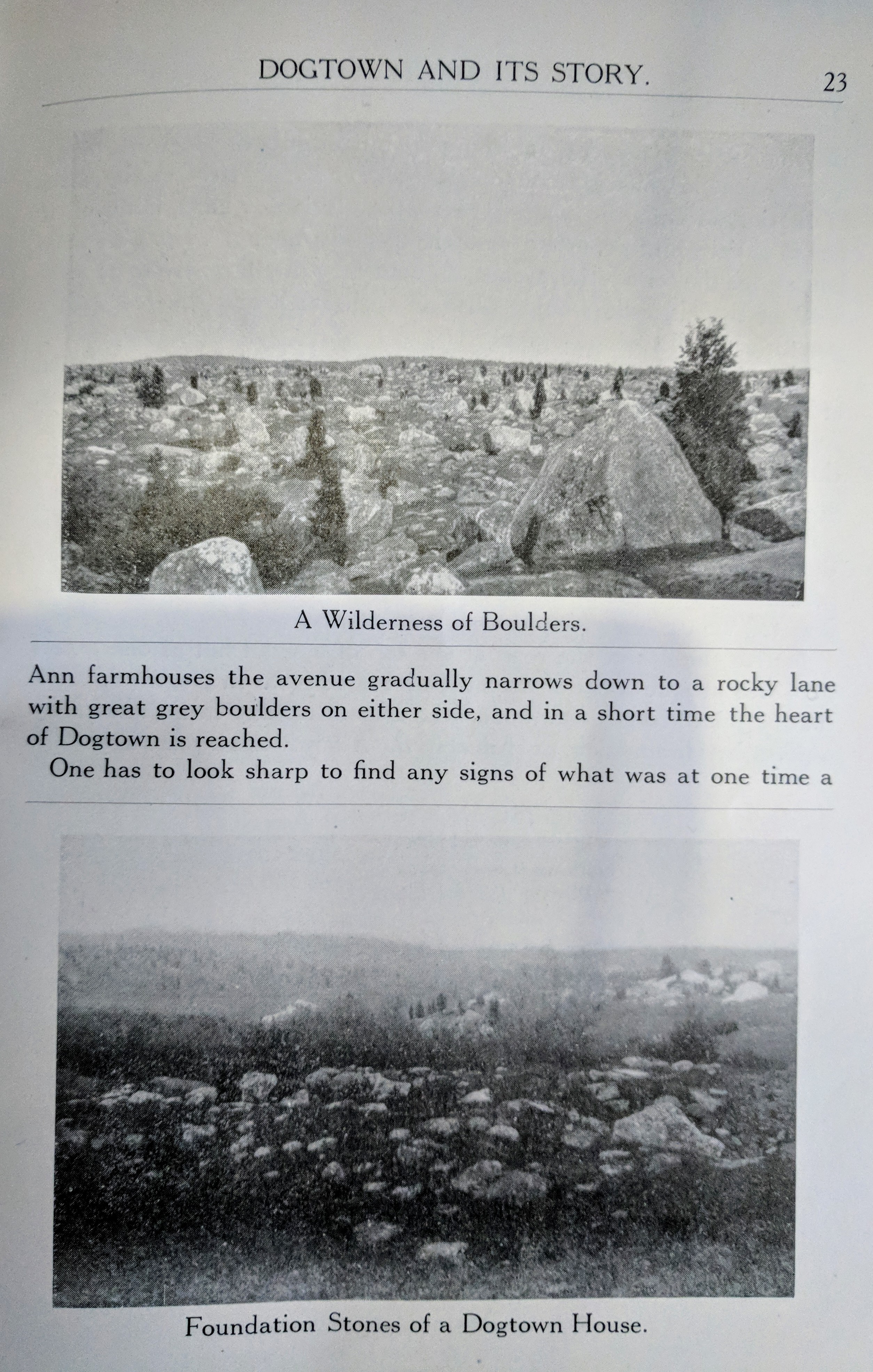
“Just to the left of the road at the top of Gee Avenue is one of the most celebrated ceallar in Dogtown. It is that of John Morgan Stanwood, who was mistakenly made famous by a poem by Hiram Rich, published in the Atlantic…”
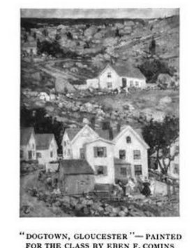
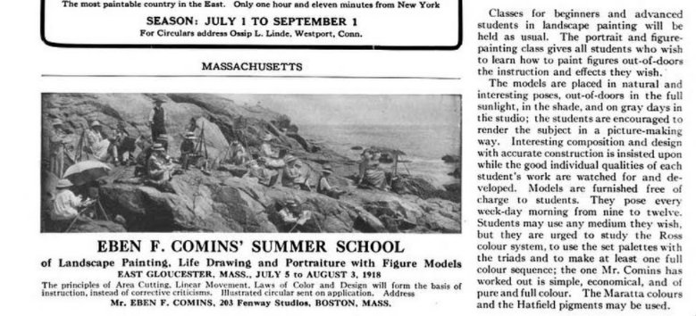
1918 Eben Comins painting
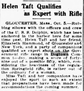
1912 government rifle range Dogtown
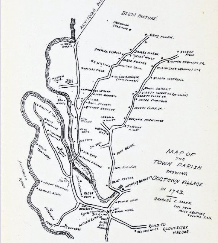
1904 (1742)
1877 Higginson
“Three miles inland, as I remember, we found the hearthstones of a vanished settlement; then we passed a swamp with cardinal flowers; then a cathedral of noble pines, topped with crow’s-nests. If we had not gone astray by this time, we presently emerged on Dogtown Common, an elevated table-land, over spread with great boulders as with houses, and encircled with a girdle of green woods and an outer girdle of blue sea. I know of nothing more wild than that gray waste of boulders..”
Dogtown, Cape Ann, described in Footpaths chapter Oldport Days
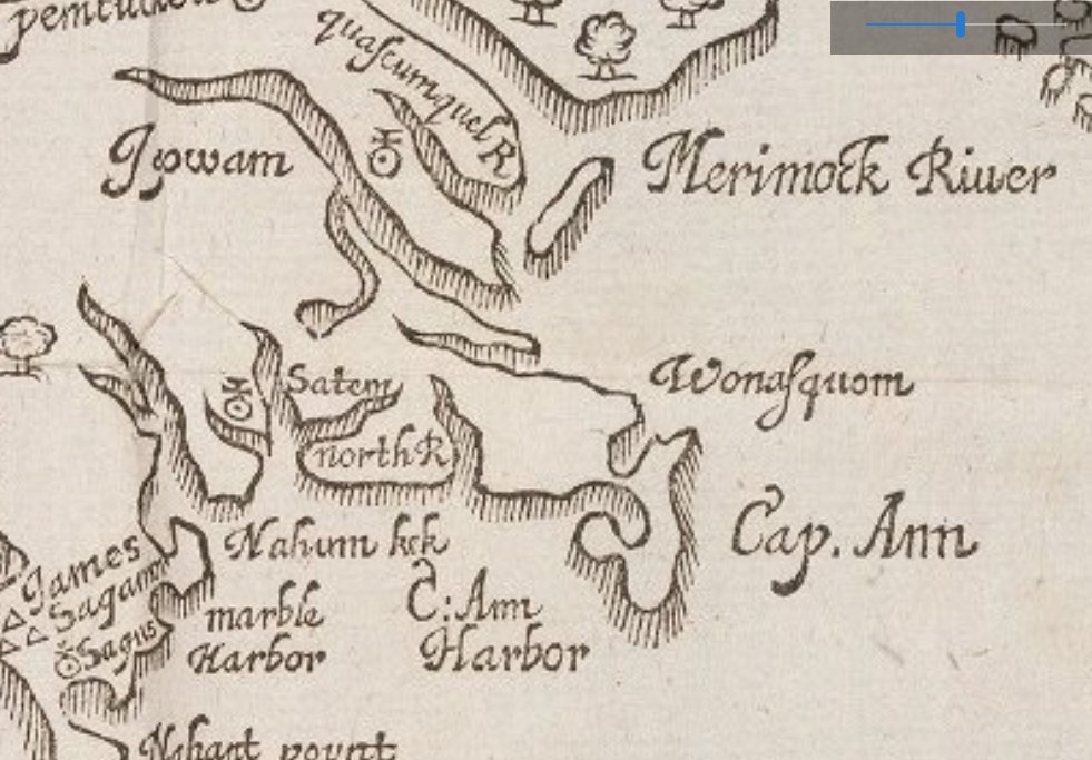
1855 Thoreau / 1634 William Wood
on clearing land…
In 1855, Henry David Thoreau wrote in his journal: “I am [reading] William Wood’s “New England’s Prospect”… William Wood New Englands Prospect was originally published in 1634 in London. Here is a Wood excerpt concerning burning brush to clear land, a historical antecedent (and apt surname) to keep in mind when considering stewardship 2017 and beyond.
…The next commodity the land affords is good store of woods, and that not only such as may be needful for fuel but likewise for the building of ships and houses and mills and all manner of water-work about which wood is needful. The timber of the country grows straight and tall, some trees being twenty, some thirty foot high, before they spread forth their branches; generally the trees be not very thick, though there may be many that will serve for mill posts, some being three foot and a half over. And whereas it is generally conceived that the woods grow so thick that there is no more clear ground than is hewed out by labor of man, it is nothing so, in many places diverse acres being clear so that one may ride a hunting in most places of the land if he will venture himself for being lost. There is no underwood saving in swamps and low grounds that are wet, in which the English get Osiers and Hasles and such small wood as is for their use. Of these swamps, some be ten, some twenty, some thirty miles long, being preserved by the wetness of the soil wherein they grow; for it being the custom of the Indians to burn the wood in November when the grass is withered and leaves dried, it consumes all the underwood and rubbish which otherwise would overgrow the country, making it unpassable, and spoil their much affected hunting; so that by this means in those places where the Indians inhabit there is scarce a bush or bramble or any cumbersome underwood to be seen in the more champion ground. Small wood, growing in these places where the fire could not come, is preserved. In some places, where the Indians died of the plague some fourteen years ago, is much underwood, as in the midway betwixt Wessaguscus and Plimouth, because it hath not been burned. Certain rivers stopping the fire from coming to clear that place of the country hath made it unuseful and troublesome to travel thorow, in so much that it is called ragged plaine, because it teares and rents the cloathes of them that pass. Now because it may be necessary for mechanical Artificers to know what timber and wood of use is in the Country, I will recite the most useful as followeth*…” *see photos for Wood’s trees list
Thoreau was thinking along these lines, finding god in berries.
“From William Wood’s New England’s Prospect, printed about 1633, it would appear that strawberries were much more abundant and large here before they were impoverished or cornered up by cultivation. “Some,” as he says, “being two inches about, one may gather half a bushel in a forenoon.” They are the first blush of a country, its morning red, a sort of ambrosial food which grows only on Olympian soil.” -Thoreau’s Wild Fruit
“If you look closely you will find blueberry and huckleberry bushes under your feet, though they may be feeble and barren, throughout all our woods, the most persevering Native Americans, ready to shoot up into place and power at the next election among the plants, ready to reclothe the hills when man has laid them bare and feed all kinds of pensioners.”
photos: William Wood’s New Englands Prospect scanned from book in the University of CA collection. “Wonasquam” on map at Cape Ann


Thomas Morton 1637
“Of their Custom in burning the Country, and the reason thereof”
The Salvages are accustomed to set fire of the Country in all places where they come, and to burne it twice a year: at the Spring, and the fall of the leaf. The reason that moves them to do so, is because it would other wise be so overgrown with underweeds that it would be all a coppice wood, and the people would not be able in any wise to pass through the Country out of a beaten path…
And this custom of firing the Country is the meanes to make it passable; and by that meanes the trees growe here and there as in our parks: and makes the Country very beautiful and commodious.”
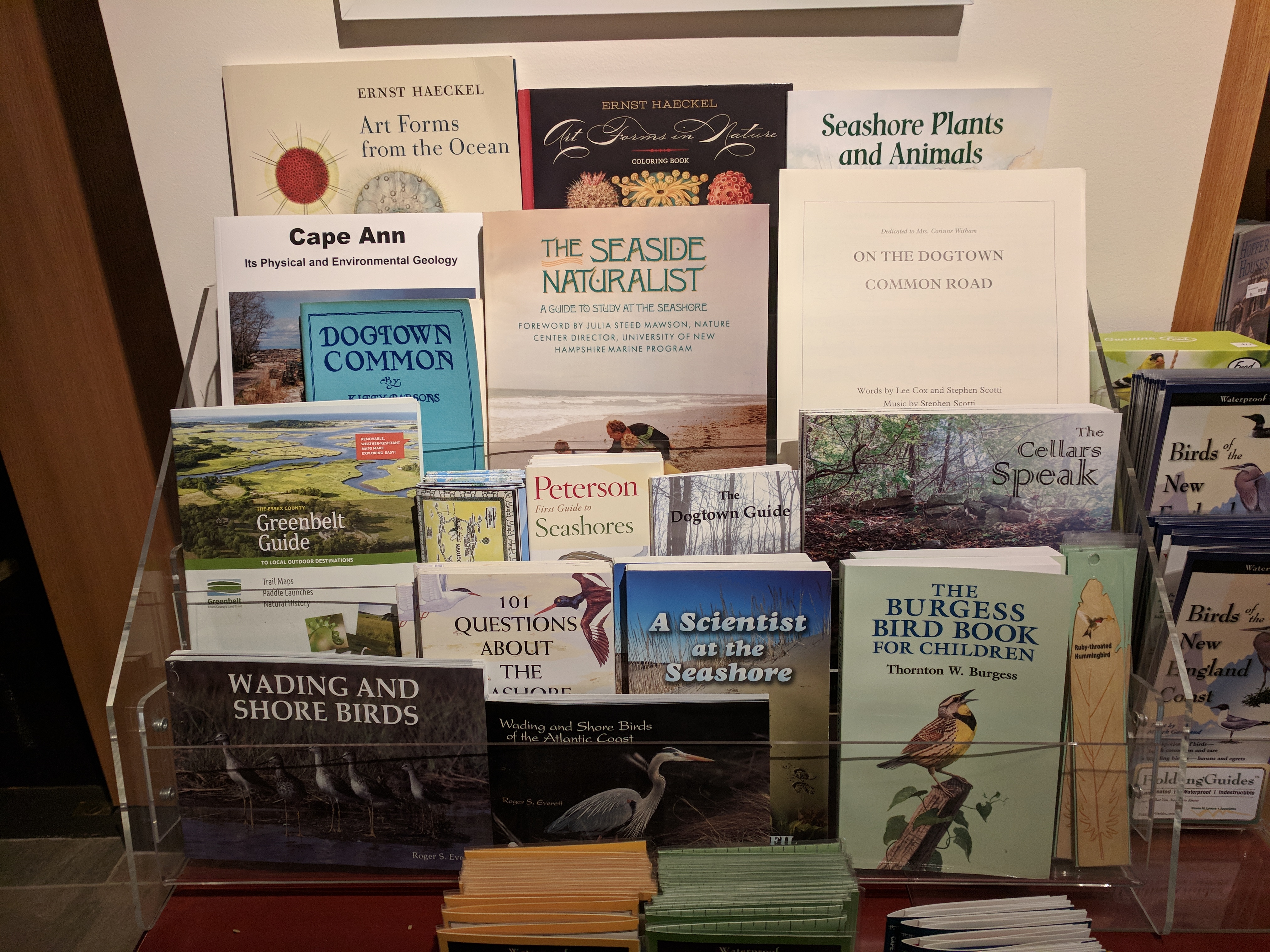
Cape Ann Museum book shop display October 2017


Thank you for this treasure trove of info about Dogtown Common.
I will be posting this on Facebook in order to save it for myself to read and re-read.
LikeLiked by 2 people
Hi, was looking through the info and didn’t see any mention of Shep Abbott, but was in a hurry so may have overlooked it. No one knows more about Dogtown than Mr Abbott. I still have a copy of the amazingly detailed map he made of Dogtown in 1999. The research, artwork, and descriptive detail are simply phenomenal, a must see!
LikeLiked by 1 person
I would love to see a copy of Shep Abbott’s map of Dogtown!
LikeLike
Interesting. No mention, however, of the great, dedicated, effort to preserve and protect Dogtown by our Retired Constable, Joe Orange. His experience and point of view, very controversial at times, is worth including in any such survey and possible program(s). Now in his 90’s, and remarkably energetic, astute and preserved, himself, Joe is a rare asset for all such concerns, while he, and Dogtown lasts.
LikeLiked by 1 person
Excellent history and I learned a bunch from this post! I was lucky to go to school at Beeman 60’s and could venture out here from time-to-time after school or on weekends! If I remember correctly was still a lot of dirt roads then unpaved! 🙂 Dave
LikeLike
Thank you for this article. Looking forward to learning more about our Cape Ann history🙄
LikeLike
Thank You, Friends of Dogtown for keeping the light burning bright. Looking forward to the archeology sessions.
LikeLike